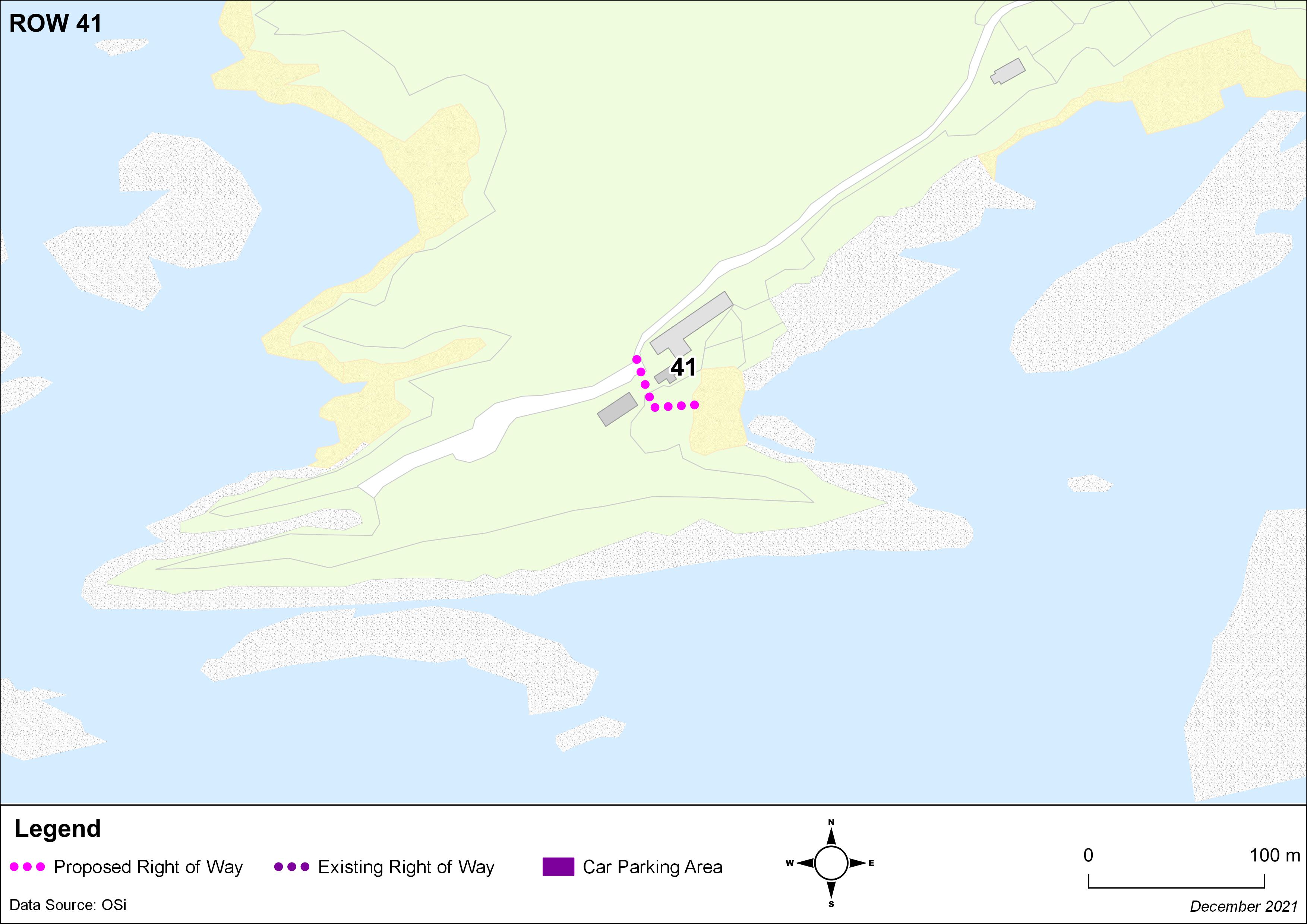
I Padraig O Suilleabhain of [Redacted] Waterville Co Kerry wish to support the inclusion of the access road to Coomatloukane beach , as a registered Right of Way.
1. Public Rights of Way
Closed6 Dec, 2021, 00:01 - 23 Feb, 2022, 17:01
The Planning and Development Acts 2000-2020 (Section 10(2)(o)) states that ‘the preservation of public rights of way which give access to seashore, mountain, lakeshore, riverbank or other place of natural beauty or recreational utility, which public rights of way shall be identified both by marking them on at least one of the maps forming part of the development plan and by indicating their location on a list appended to the development plan’.
Policies and Objectives relating to Rights of Way can be found in Section 14.8 of the Draft Kerry County Development Plan 2022-2028.
It is important to note that this is not an exhaustive list and that the omission of a Right of Way from this list shall not be taken as an indication that such a Right of Way is not a Public Right of Way.
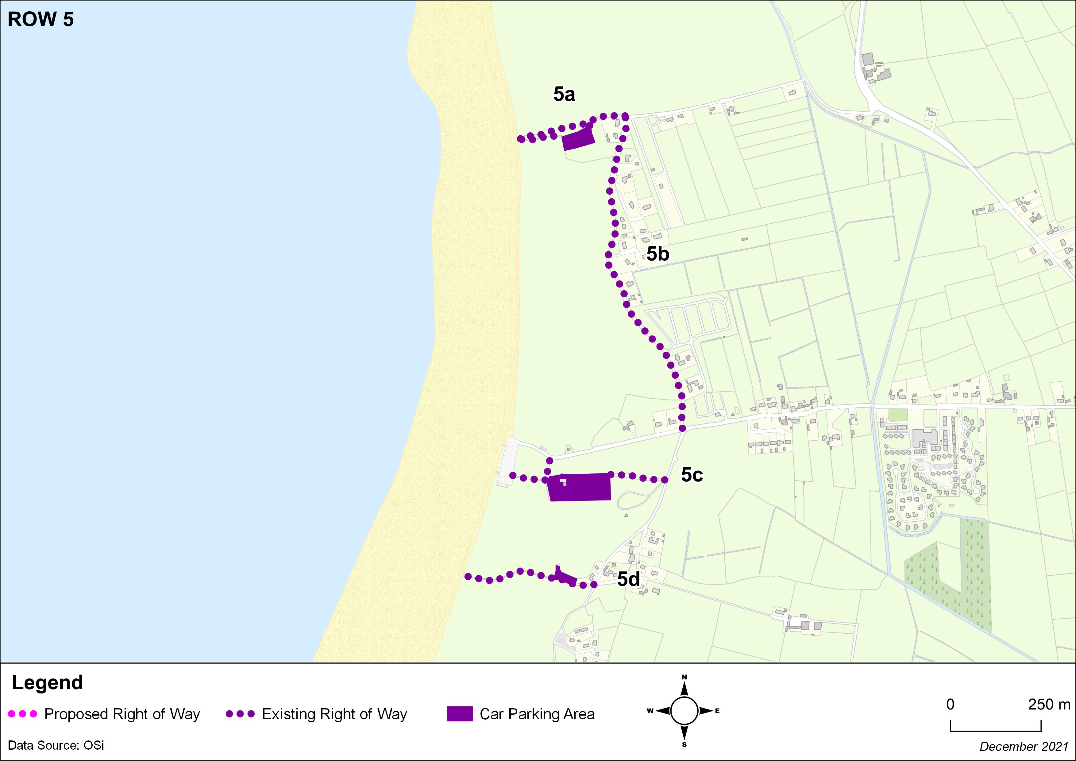
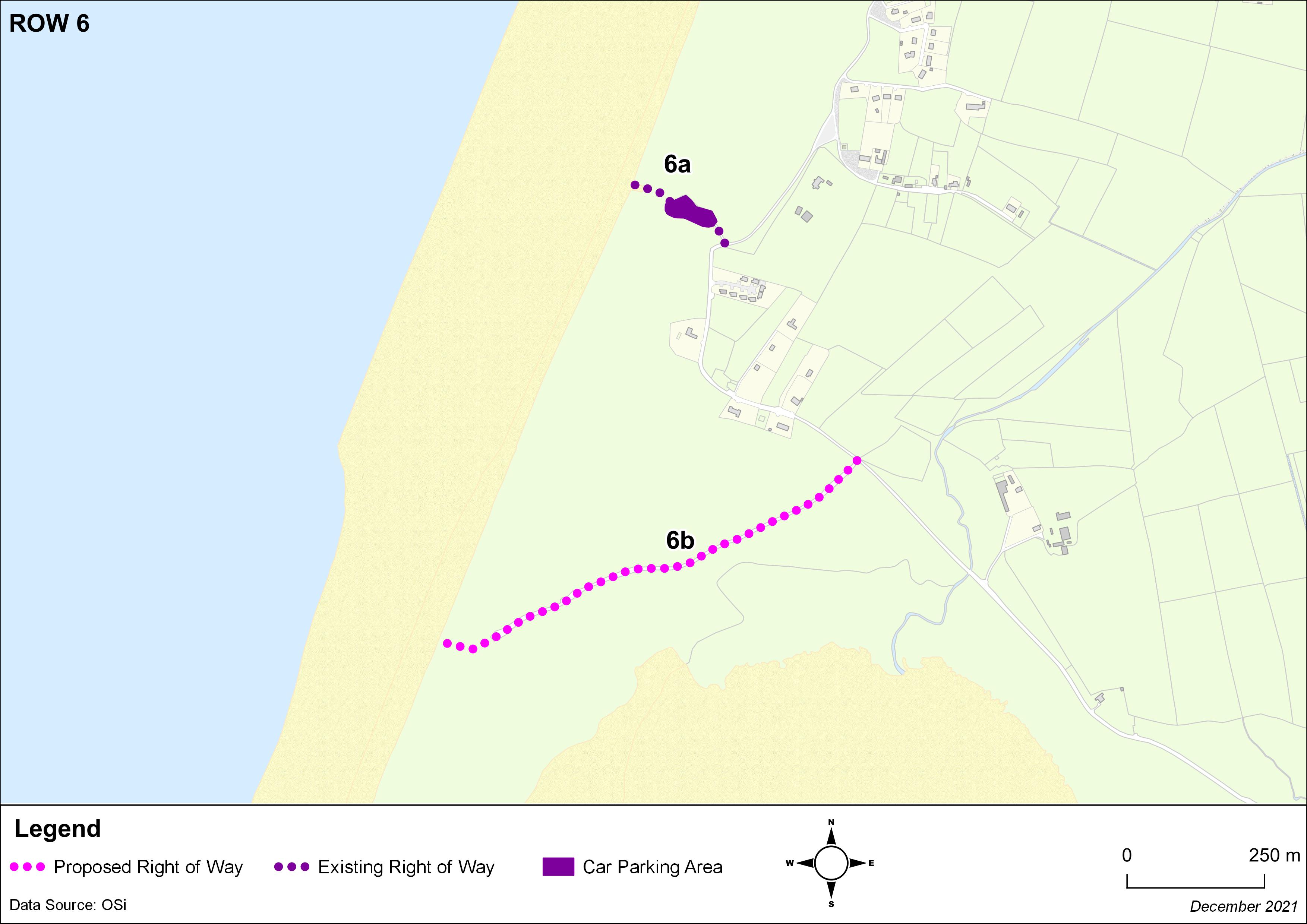
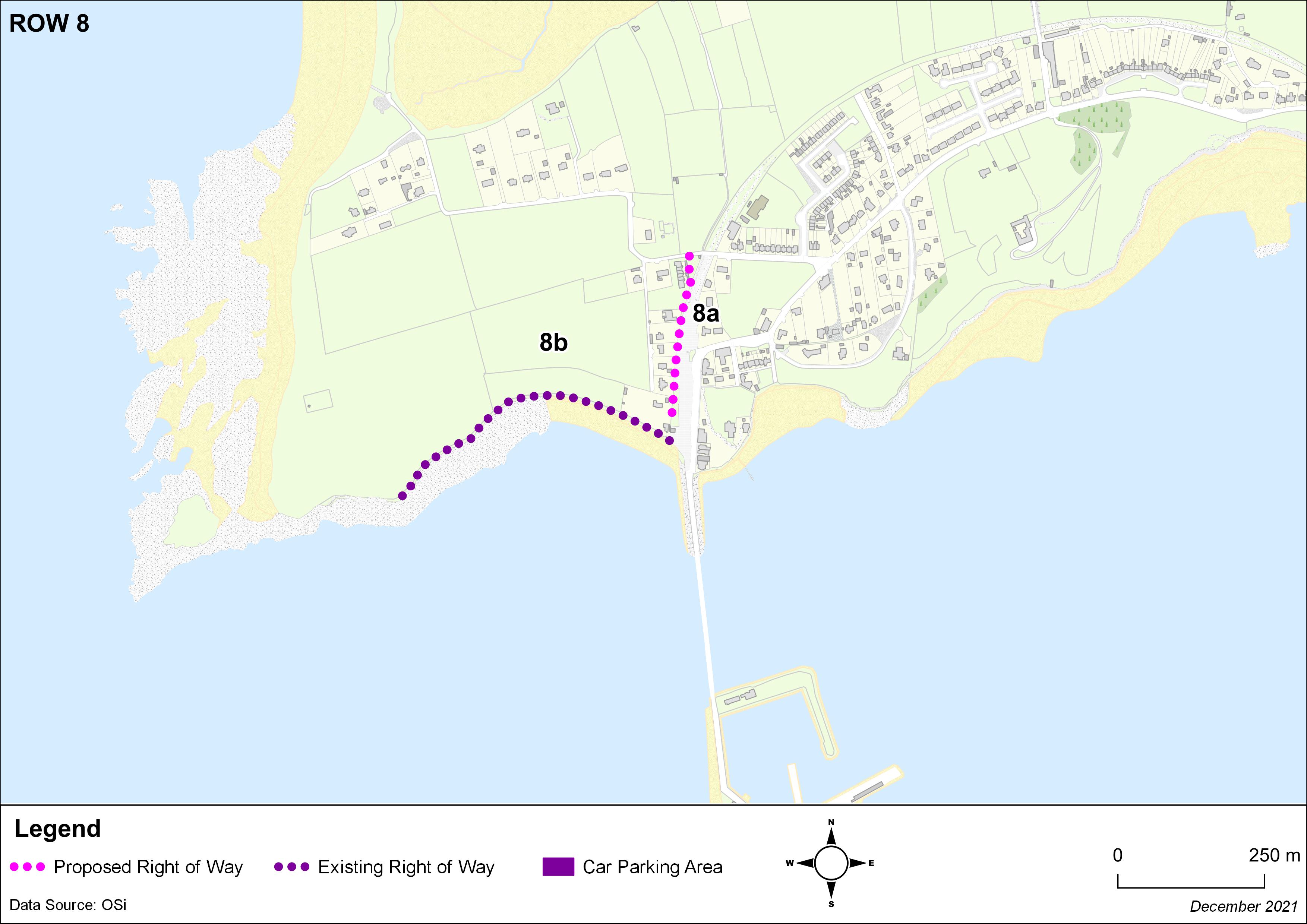
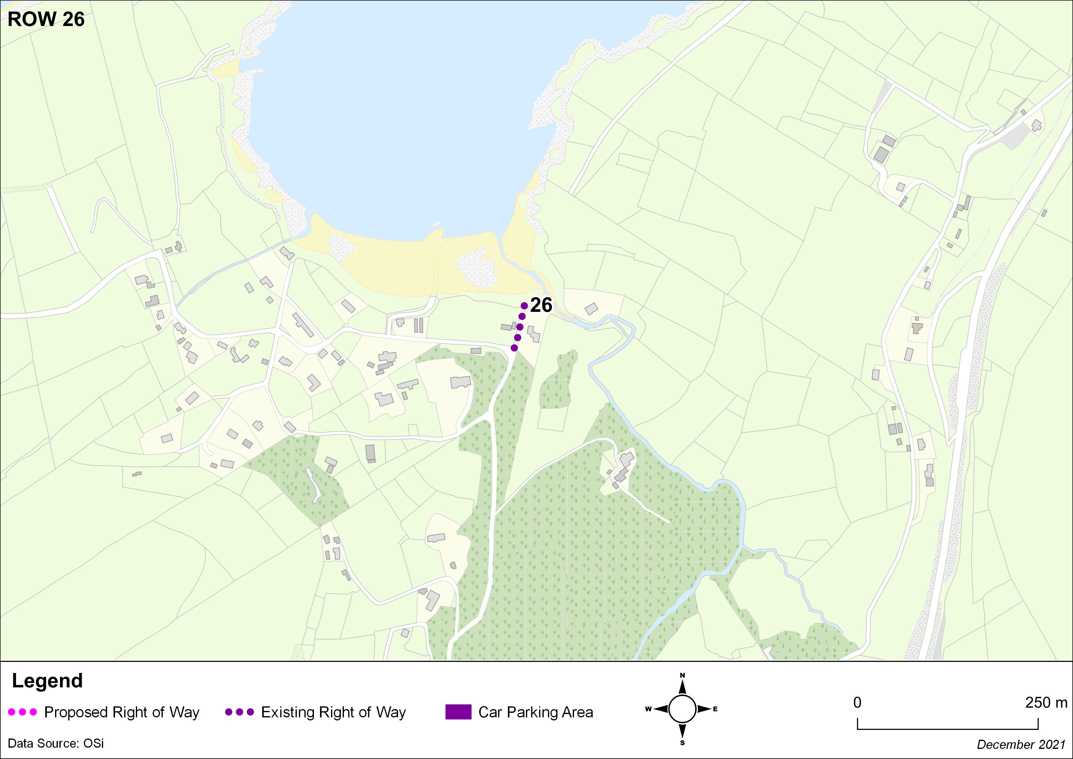
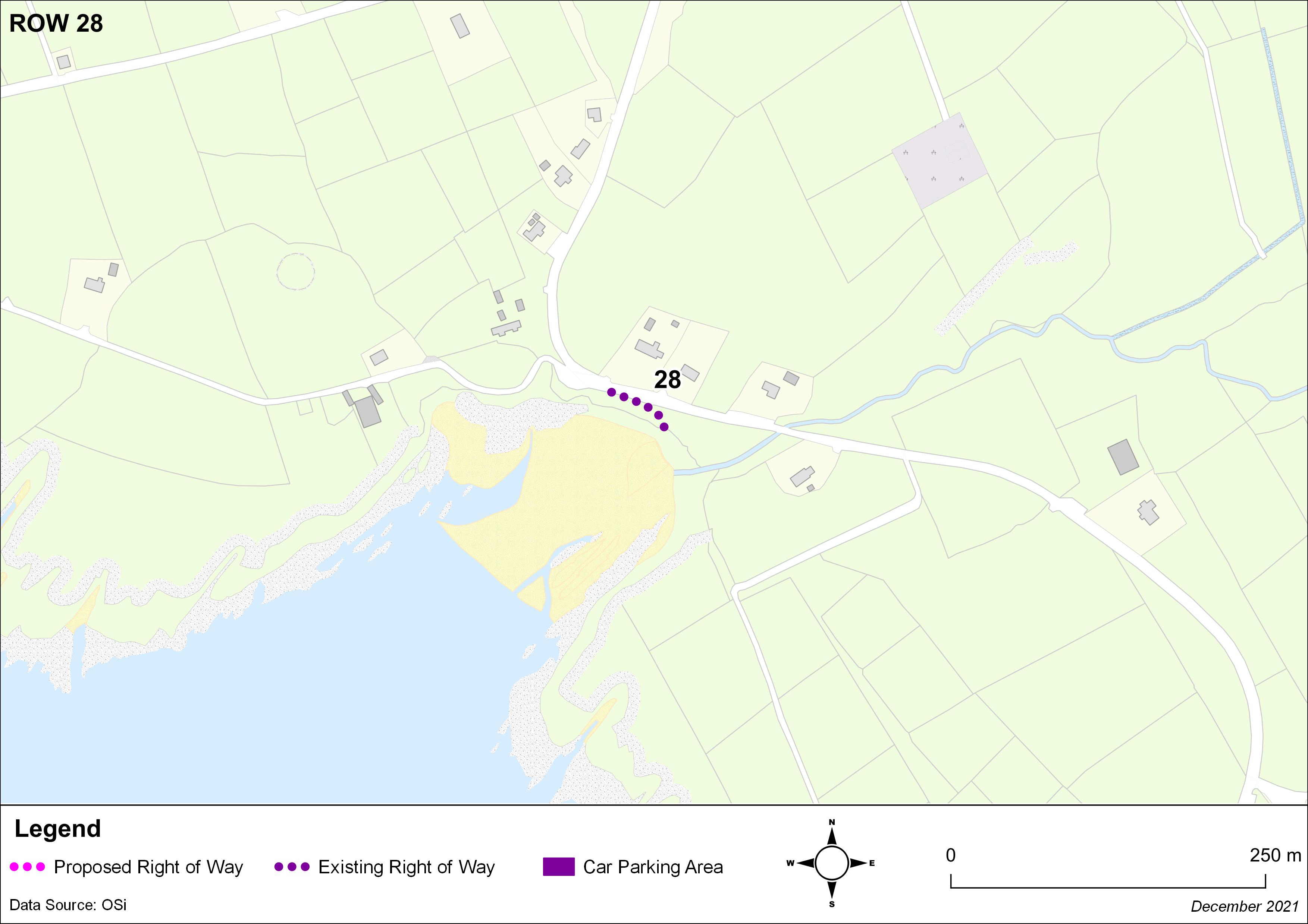
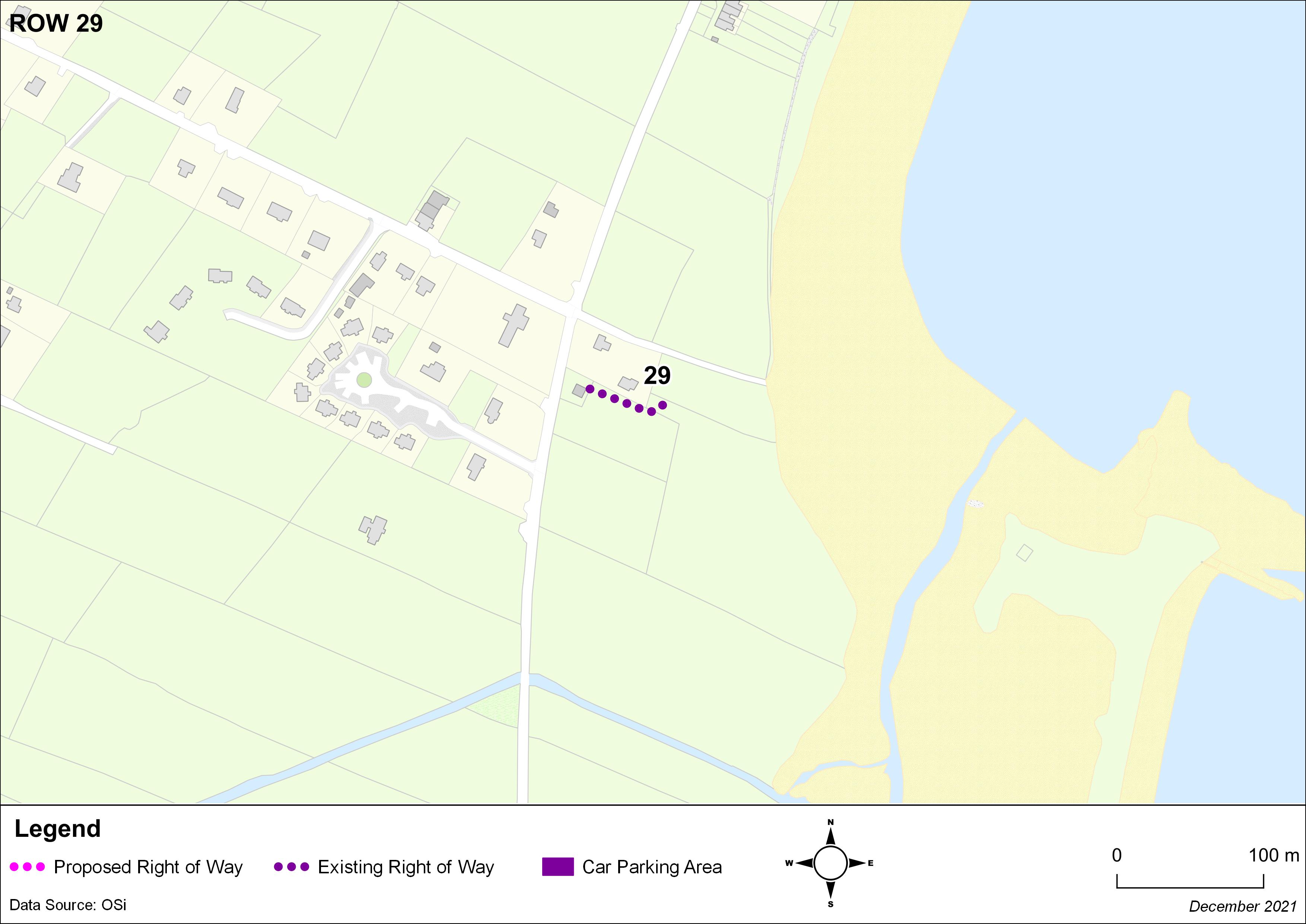
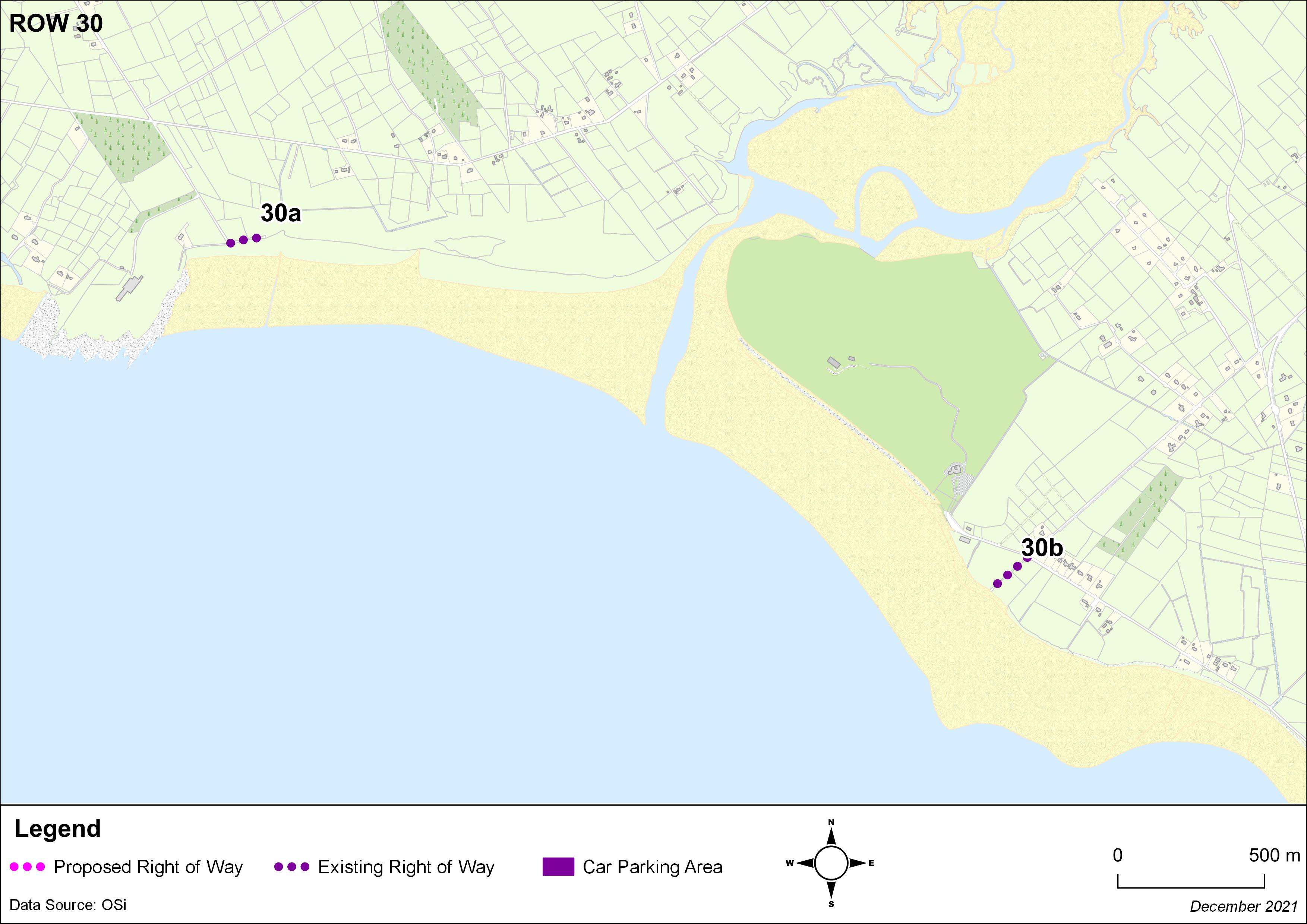
It is proposed to add ROW 6b, ROW 8a and ROW 41 to the list of public rights of way that was included in the Kerry County Development Plan 2015-2021.
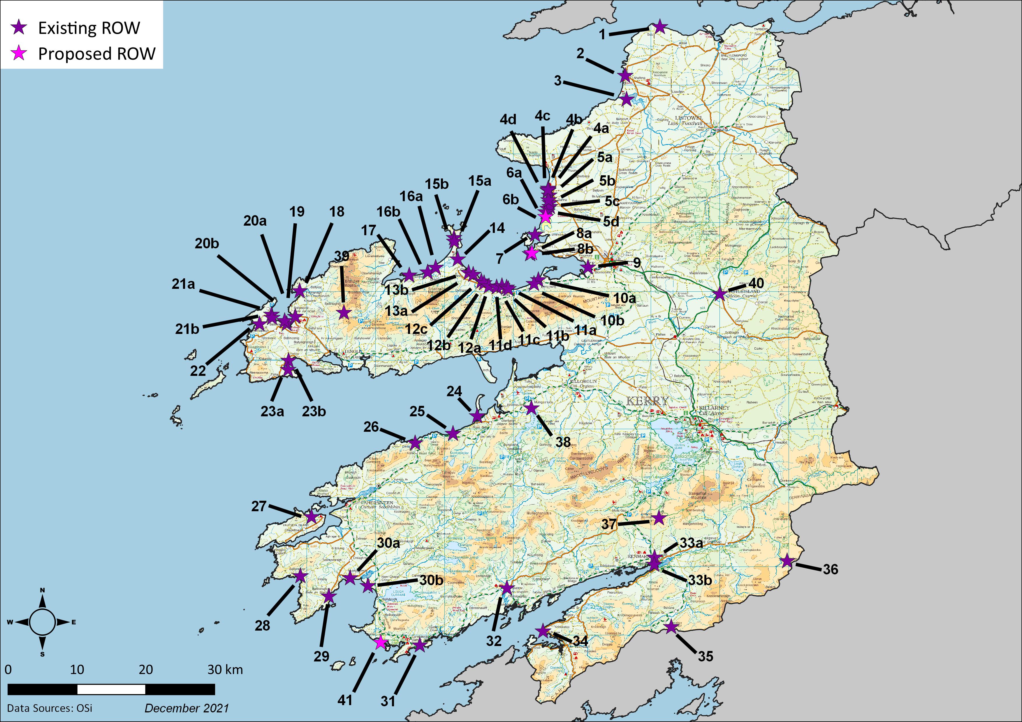
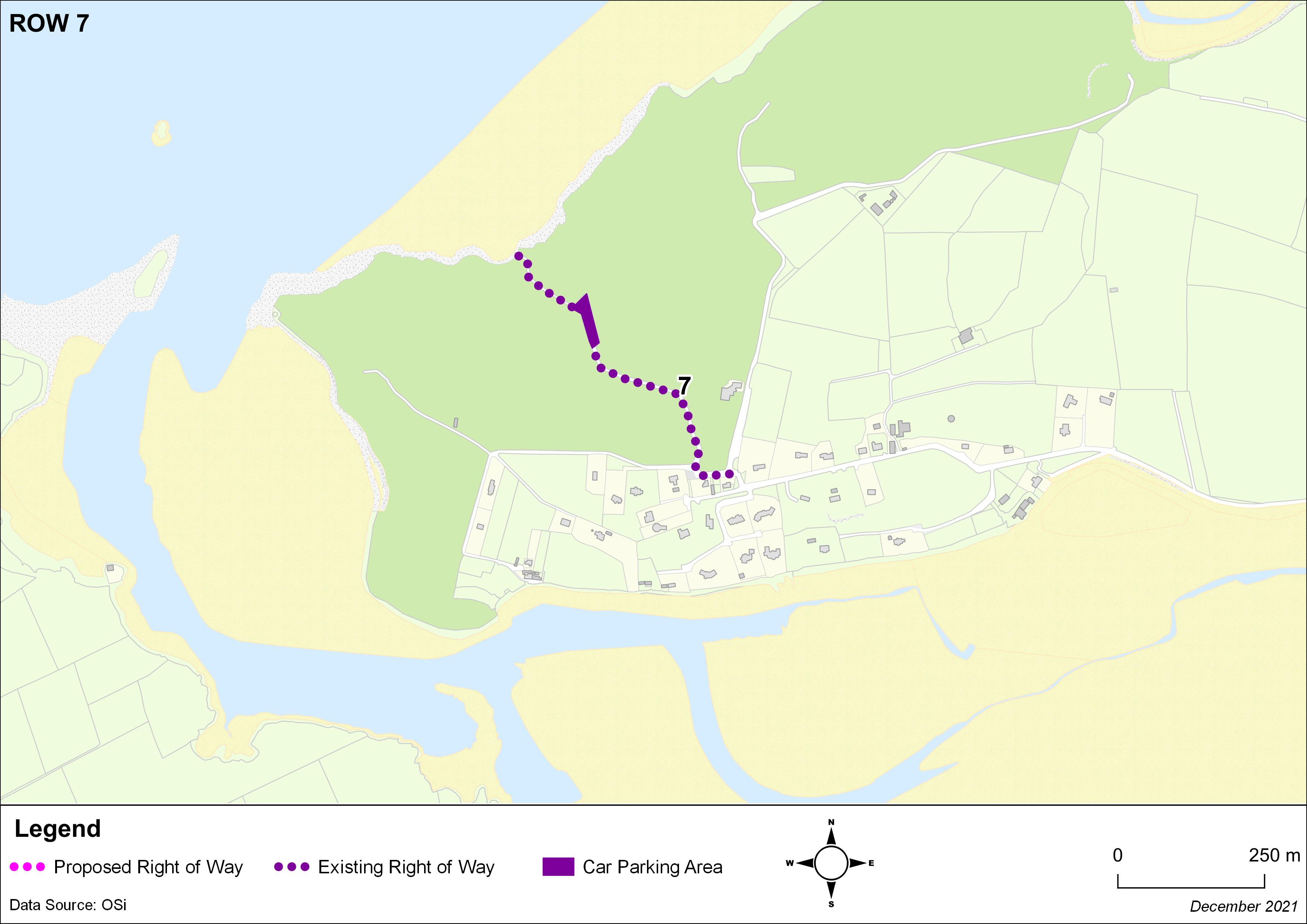
Individual ROW maps are linked from the reference number in the table below
|
KCDP 2022-2028 |
Description |
|
Access to the beach from the L6003 in the townland of Castlequarter, Beal, Ballybunion. |
|
|
Access to the beach from the L1002 opposite Ozone Tce, Ballybunion. |
|
|
Access to the beach from the L6038 in the townland of Knoppoge, The Cashen. |
|
|
From the L10472 in Ballinprior to the beach, over Akeragh Bridge. |
|
|
From the L10472 in Ballinprior to the beach, crossing a bridge over the Akeragh River and then near the river until reaching the beach. |
|
|
From the L10472 in Ballinprior past the farm buildings and then to the beach along the south side of the Akeragh River. |
|
|
From the end of the L10470 along the tracks to the beach (Ballinprior / Commons). |
|
|
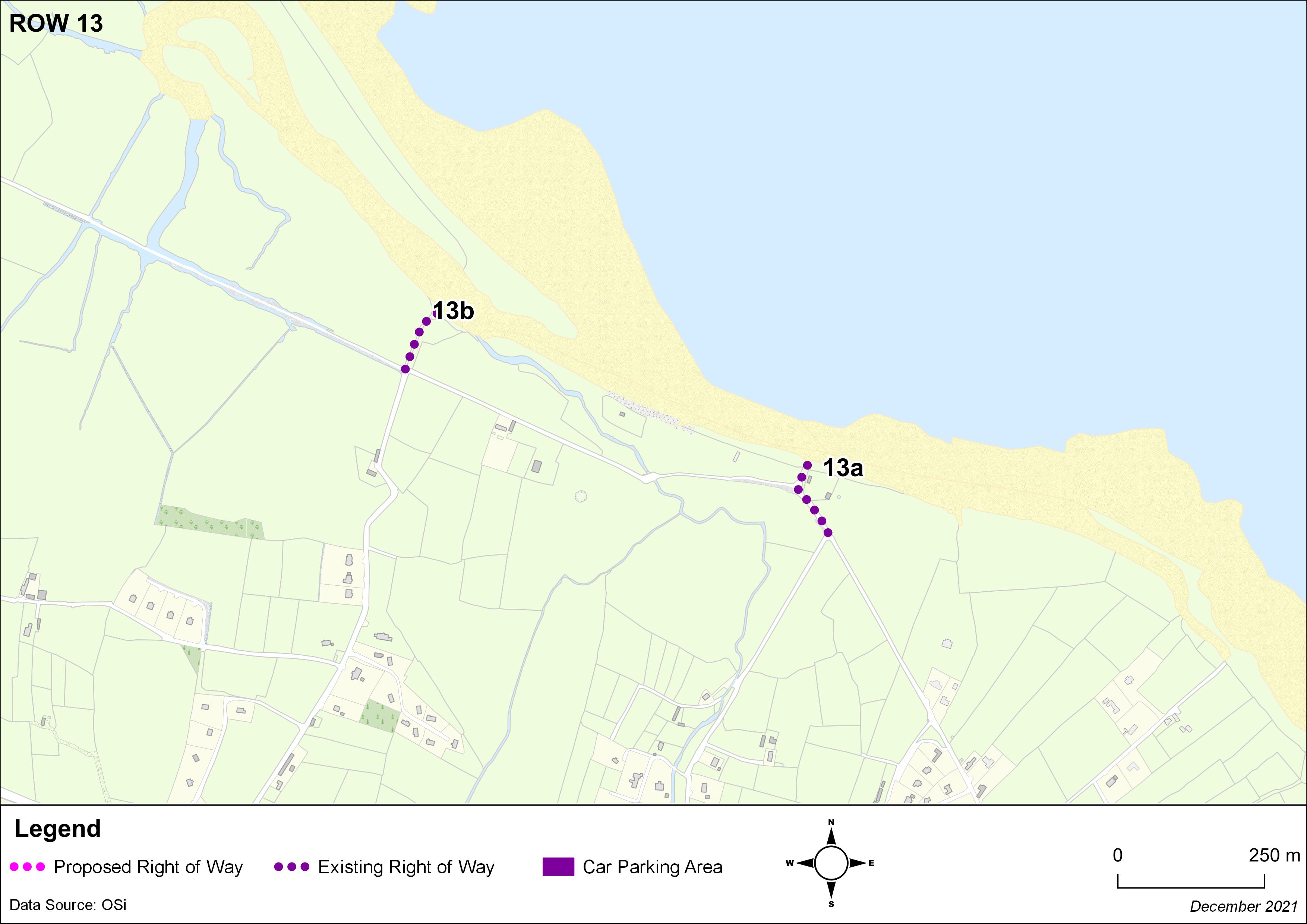
Access to the beach from the L10476 and associated parking area, Banna Mountain. |
|
|
Road between the L6092 and L10476, Banna Mountain. |
|
|
Access to the beach carpark and grass carpark surrounding the Banna Sea Rescue building in the townland of Carrahane Lower. |
|
|
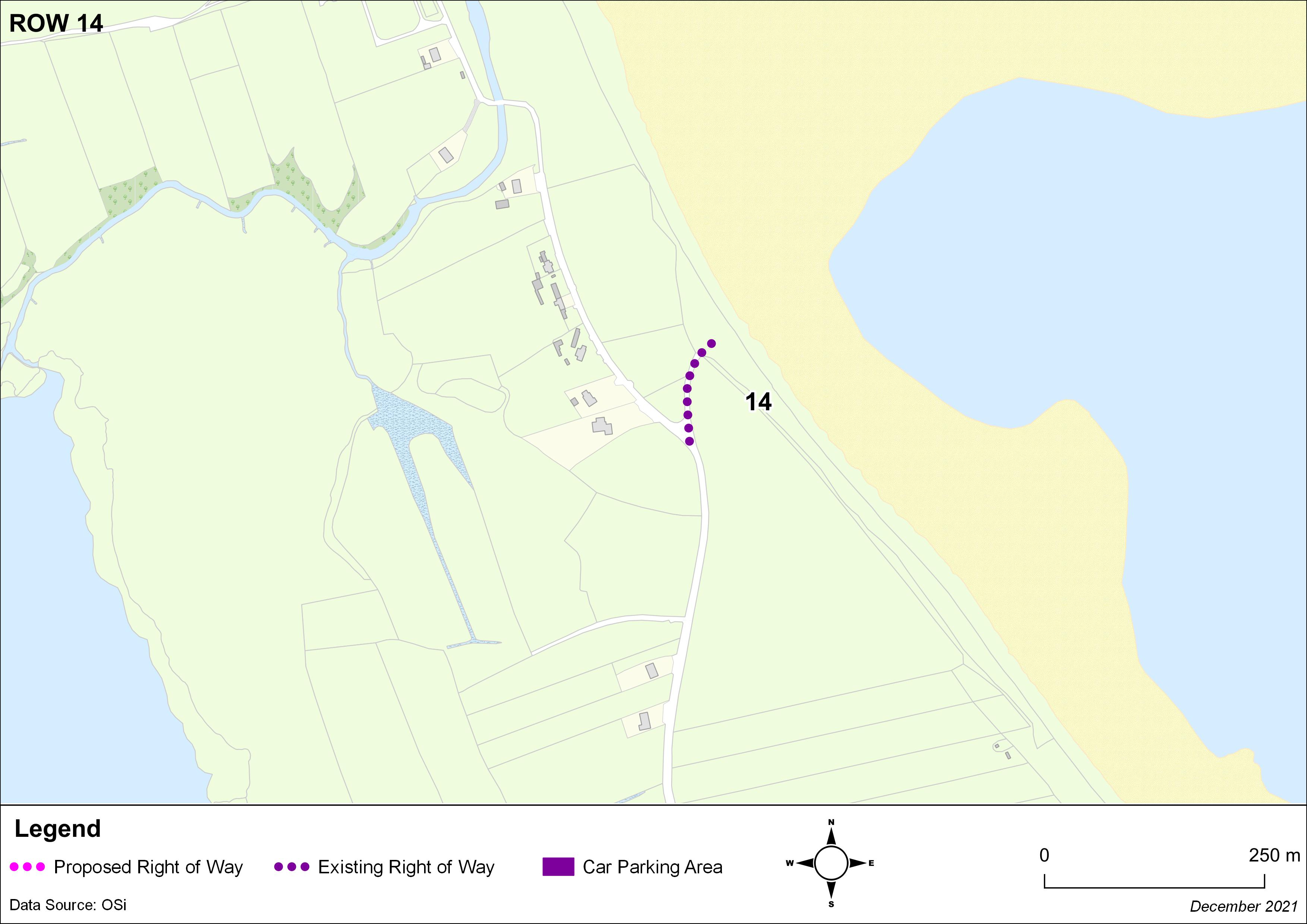
Access to the beach and associated carpark in the townland of Banna Mountain. |
|
|
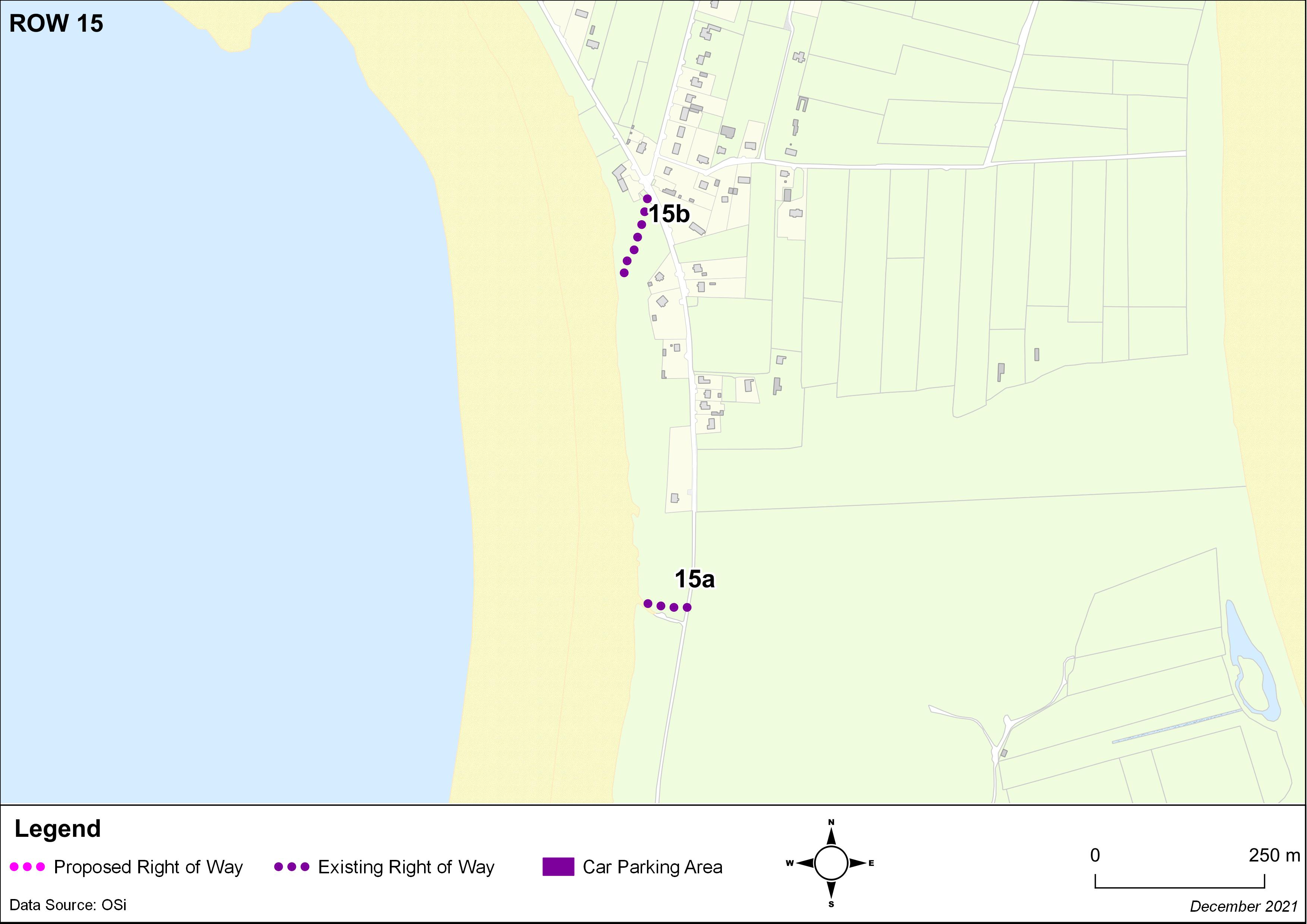
Access to the beach and associated carpark in the townland of Carrahane Lower. |
|
|
Access to the beach from the L10483 at Carrahane Lower. |
|
|
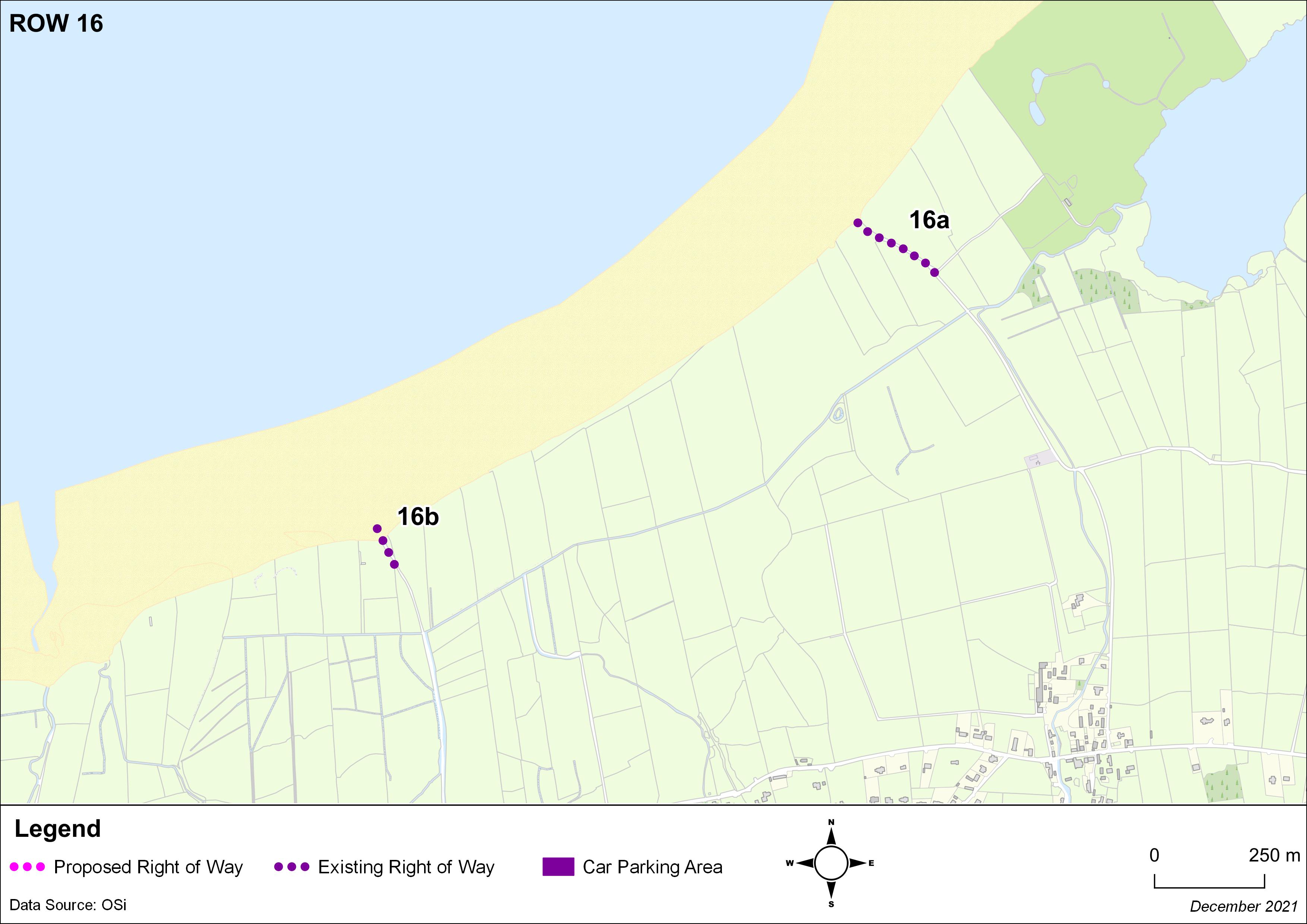
From the end of the L6501 in Barrow to the beach (through the Golf Course). |
|
|
From the L10572 in Fenit past the Coastguard Station to the old boat house/slip adjacent to the car park in Fenit. |
|
|
The path from the carpark before the bridge to the pier in Fenit westwards along the coast. |
|
|
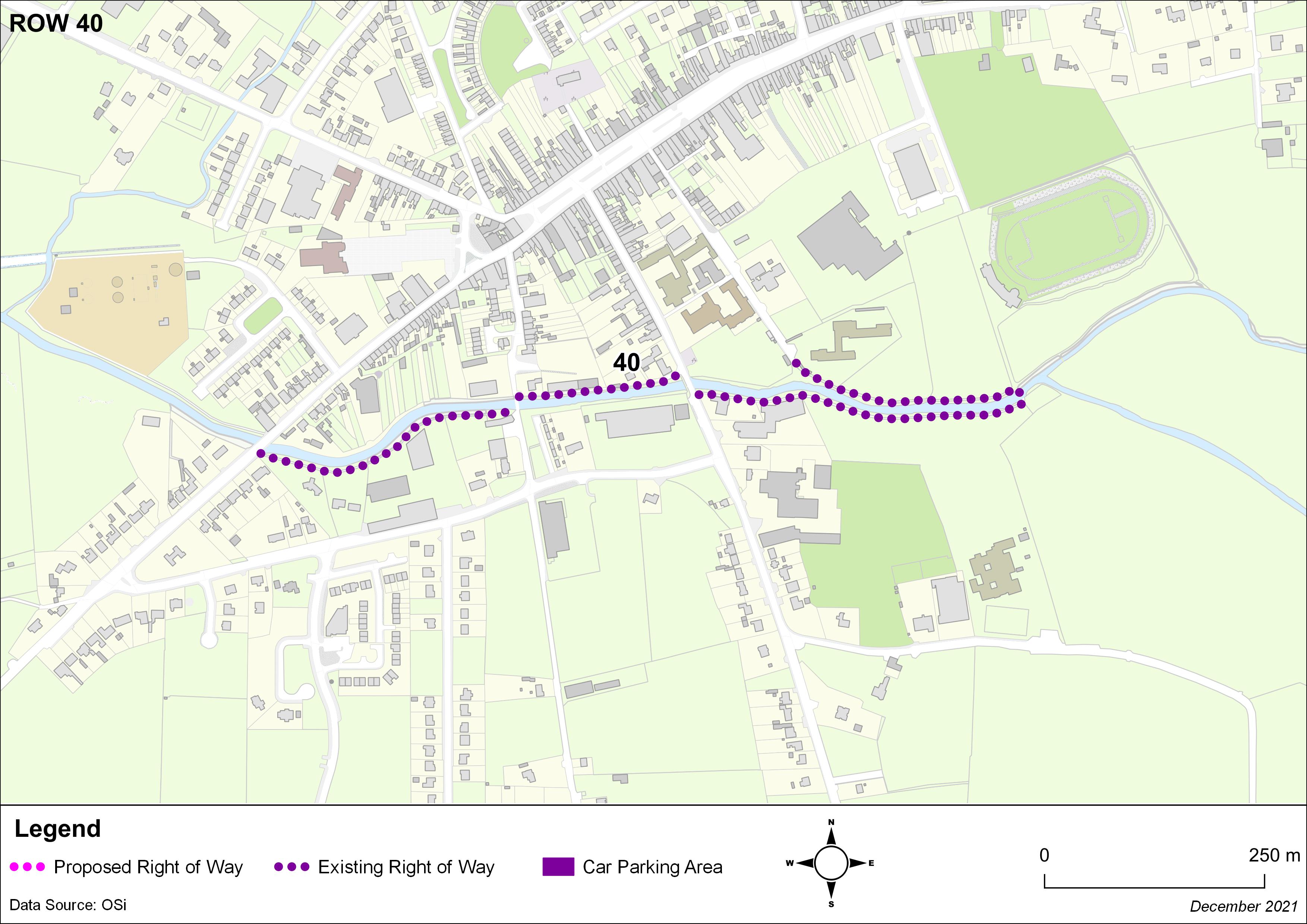
Path along the canal in Tralee from the urban boundary to the carpark located at the end of the L10584, approx. 550m. |
|
|
Access to the beach via a track from the Derrymore Beach carpark. |
|
|
Access to the beach via a track from the end of the L8010 in Derrymore West. |
|
|
Access to the beach in Ballinknockane, Camp from the end of the L12164. |
|
|
Access to the beach in Tonakilly, Camp from the end of the L12163. |
|
|
Access to the beach in Cappaclogh East, Camp from the end of the L12162. |
|
|
Access to the beach in Cappaclogh West, Camp from the end of the L12161. |
|
|
Access to the beach via a track from the end of the L12160 in Meennascarty. |
|
|
Acccess to the beach from the end of the L12159 in Carrigaha ,Aughacasla South. |
|
|
Acccess to the beach from the end of the L12158 in Aughacasla South. |
|
|
Access to the beach via a track in Aughacasla North from the L12157. |
|
|
Access to the beach via a track from the L12263 in Tullaree, Aughacasla. |
|
|
Access to the beach in Magherabeg by a track east from the L5014 south of Trench Bridge. |
|
|
Access to the beach in Magherabeg west from the L5014. |
|
|
Access to the beach in Kilshanning by the grotto from the L5014. |
|
|
Access to the beach in Barrack, Stradbally from the L5013. |
|
|
Access to the beach in Gowlane, Stradbally from the L8021. |
|
|
Access to Fermoyle Beach from the L12110. |
|
|
Access to Feohanagh Beach from the L12054. |
|
|
Access from Muiríoch to the beach. |
|
|
Access to the beach from the R559/L12039 junction. |
|
|
Access to the beach from the L8033 Baile an Reannaigh. |
|
|
Access to the beach from the L8033 Wine Strand. |
|
|
Access to the beach from the end of the L8050 Gorta Dubh. |
|
|
Access to the beach from the end of the L8034 Gorta Dubh. |
|
|
Access to the beach from the L8070 Ferriters Cove. |
|
|
Access to the beach from the L8074 Raheen. |
|
|
Access to the beach from the end of the L8042 Fionn Trá. |
|
|
Access to the back beach in Rossbeigh from the end of the L11809, a distance of approx. 650m. |
|
|
Access to the shore from the end of the L11645 in Coolnaharragill/Kilkeehagh. |
|
|
Access to the beach in Kells from the L7519/L4016. |
|
|
Access to the shore in Glanleam Knightstown from the end of the L11509. |
|
|
Access to the beach from the L4003 in Rathkieran. |
|
|
Path between public toilets and Ballinskelligs Beach Carpark. |
|
|
Access to the beach via a track from the end of the L7535 Reenroe. |
|
|
Access to the beach via a track from the junction of L4009 and L11582 Murreagh. |
|
|
Access to the White Strand from the N70 at Carroll’s Cove. |
|
|
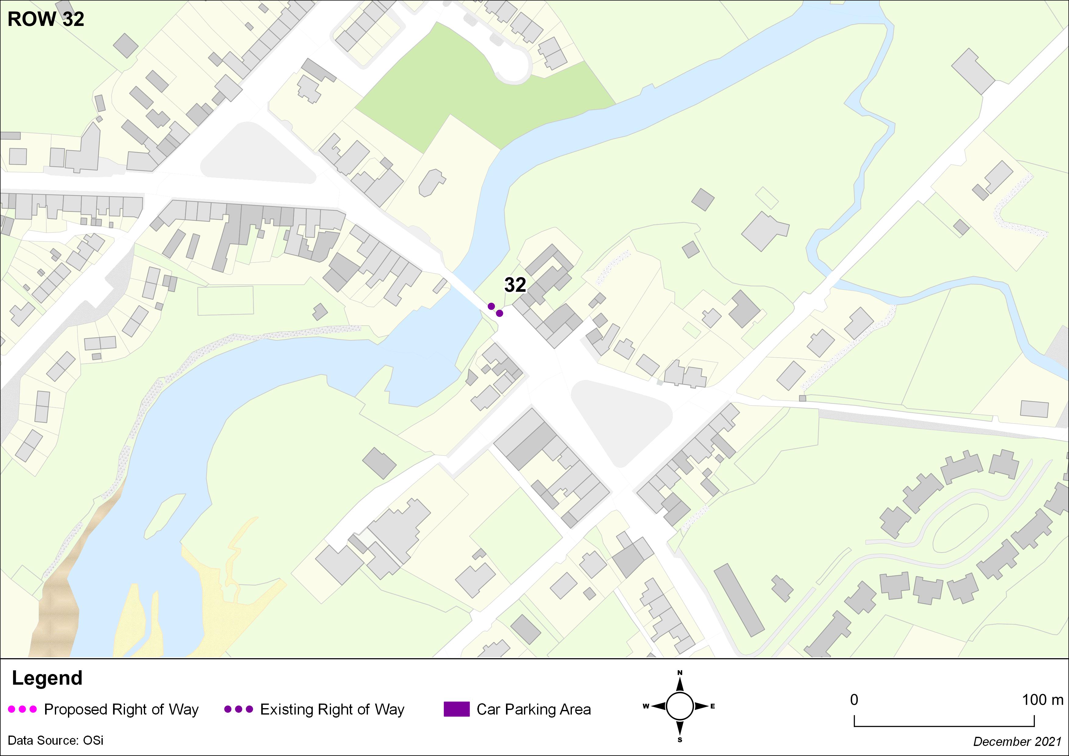
Access to the Sneem River adjacent to the bridge on the N70 in the centre of Sneem. |
|
|
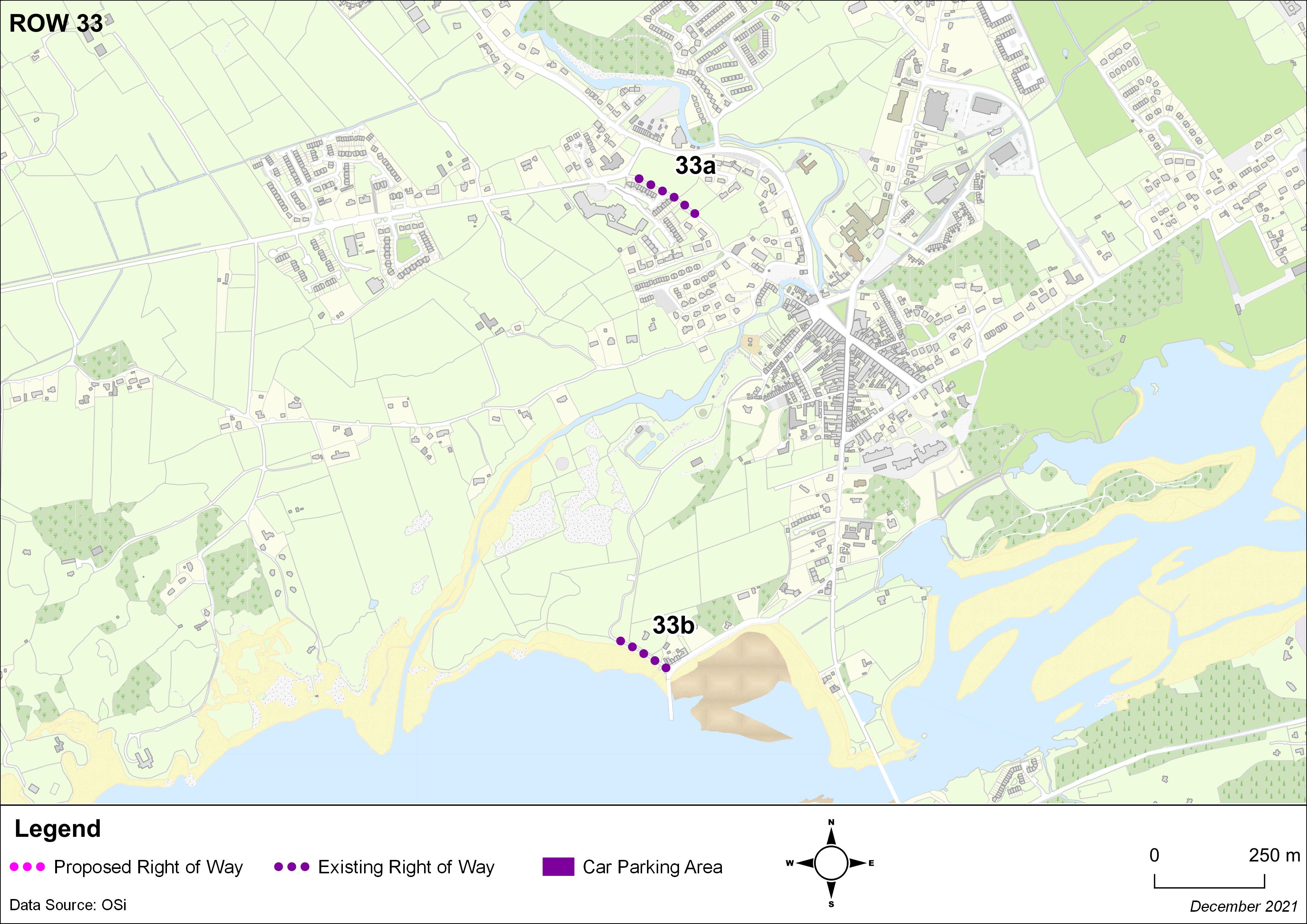
Path between the N70 and the L7610 adjacent to the Kenmare Bay Hotel. |
|
|
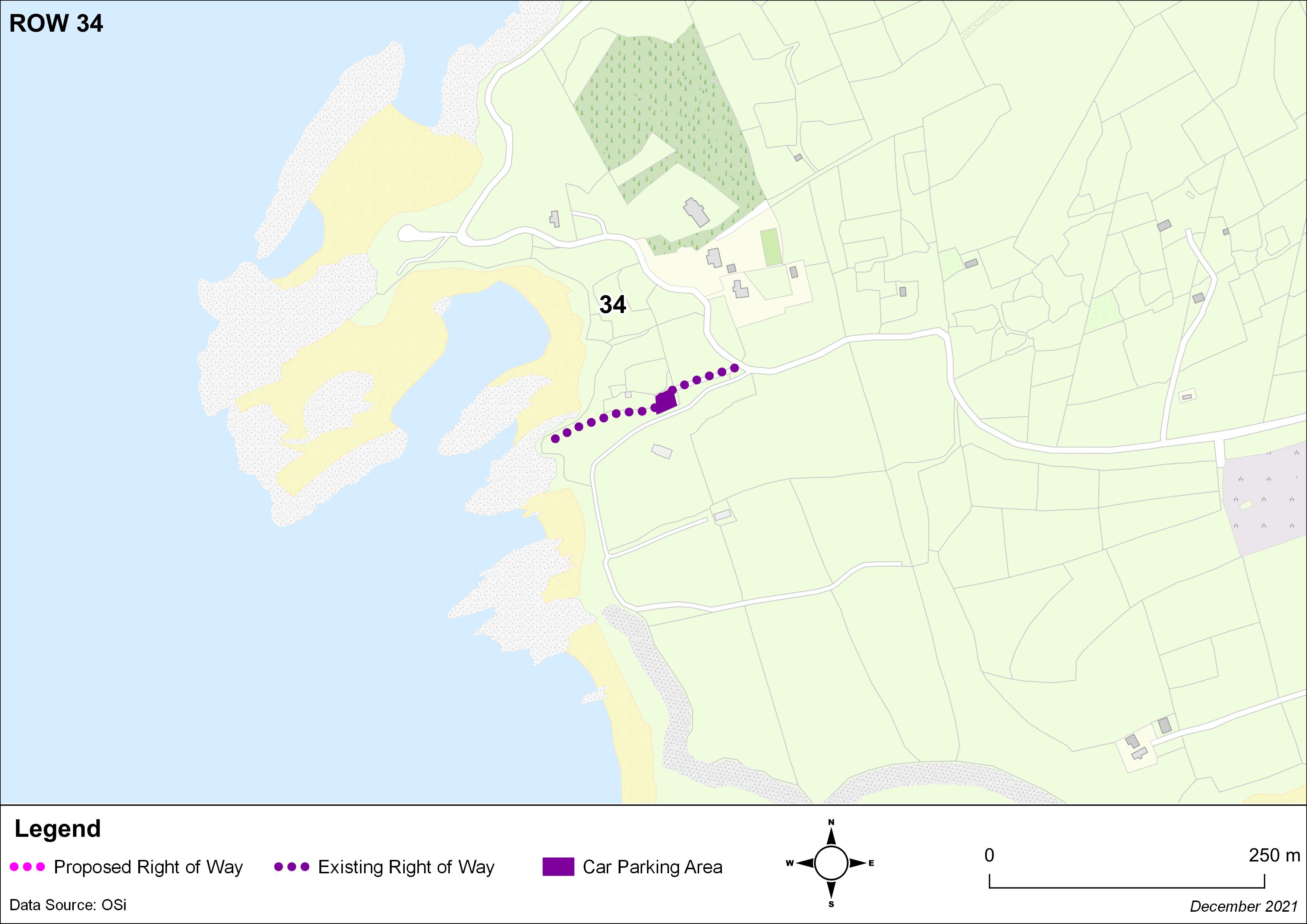
From the end of the L7606 westwards for a distance of approx. 100m, The Pier, Kenmare. |
|
|
Access to Kilmakillogue Viewing Point, including roadway, carpark and paths. |
|
|
Track from the L11774 in Esk East to the County Bounds. |
|
|
Track from the L11187 in Grousemount to the County Bounds. |
|
|
The Old Kenmare Road from the L4052 to the Killarney National Park Boundary in Incheens. |
|
|
Access to Caragh Lake via a track from the L4020 in Tooreennasliggaun. |
|
|
Path/Track between the L12063 and L12037. |
|
|
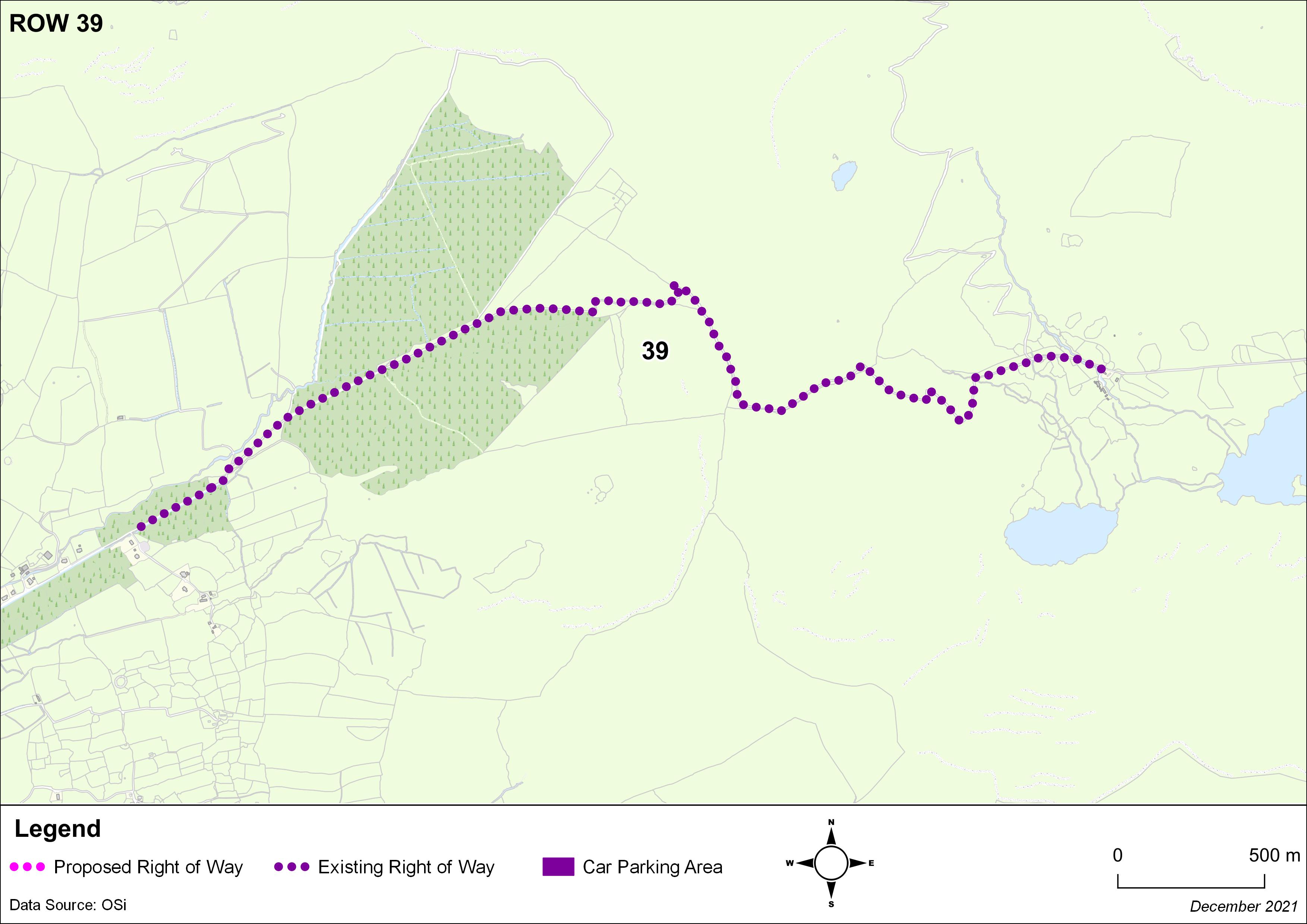
Paths along the River Maine in Castleisland. |
|
|
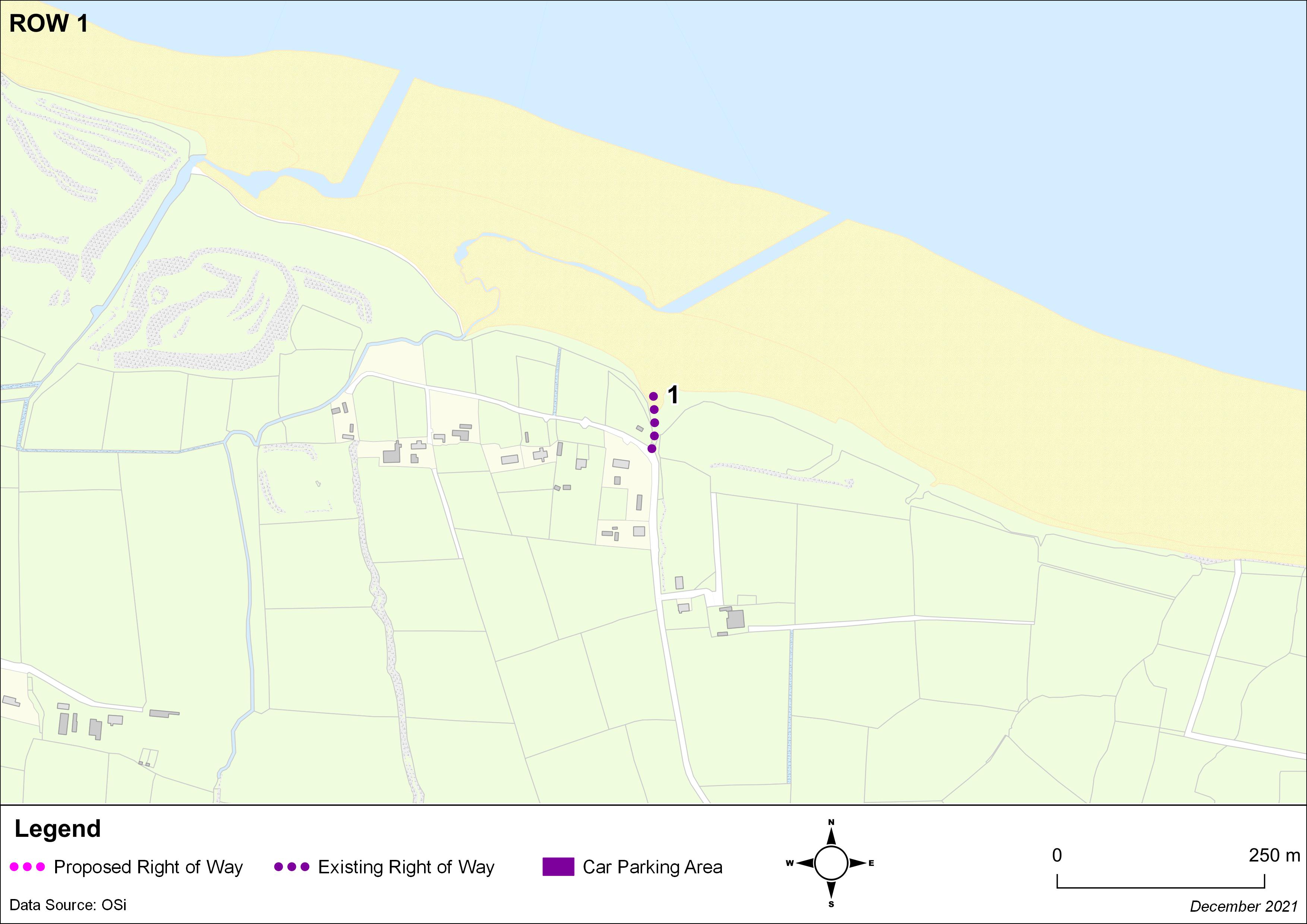
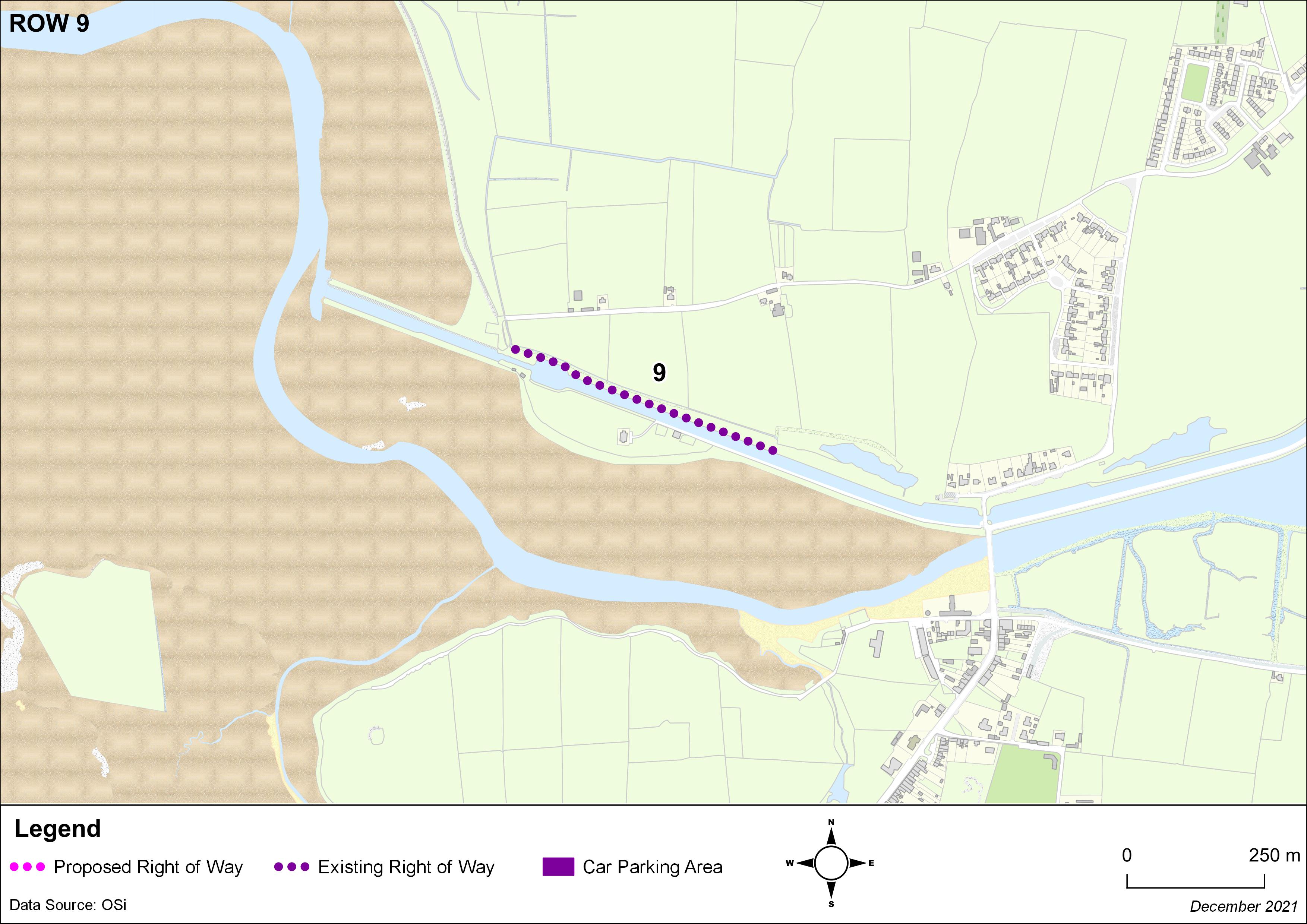
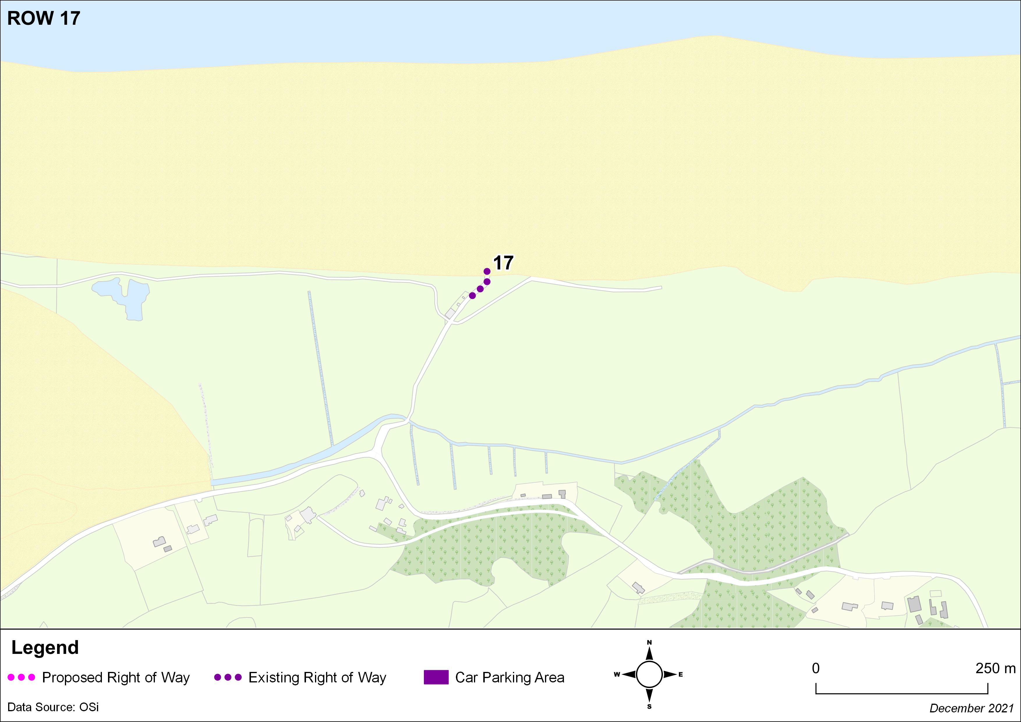
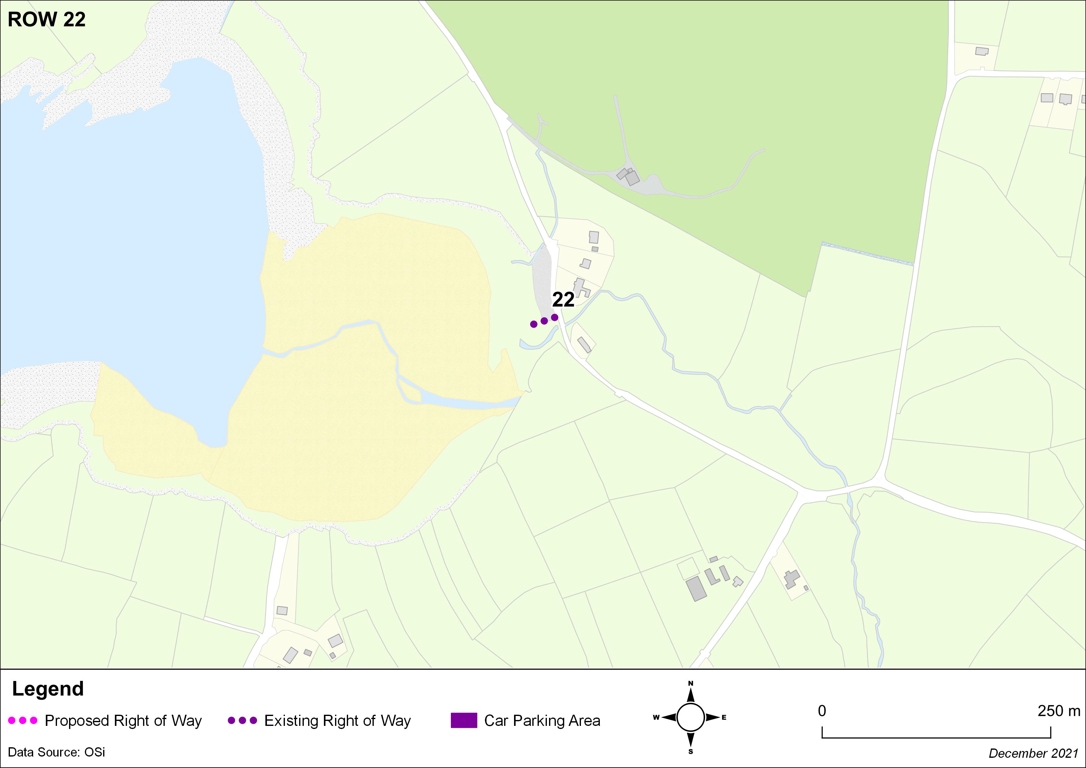
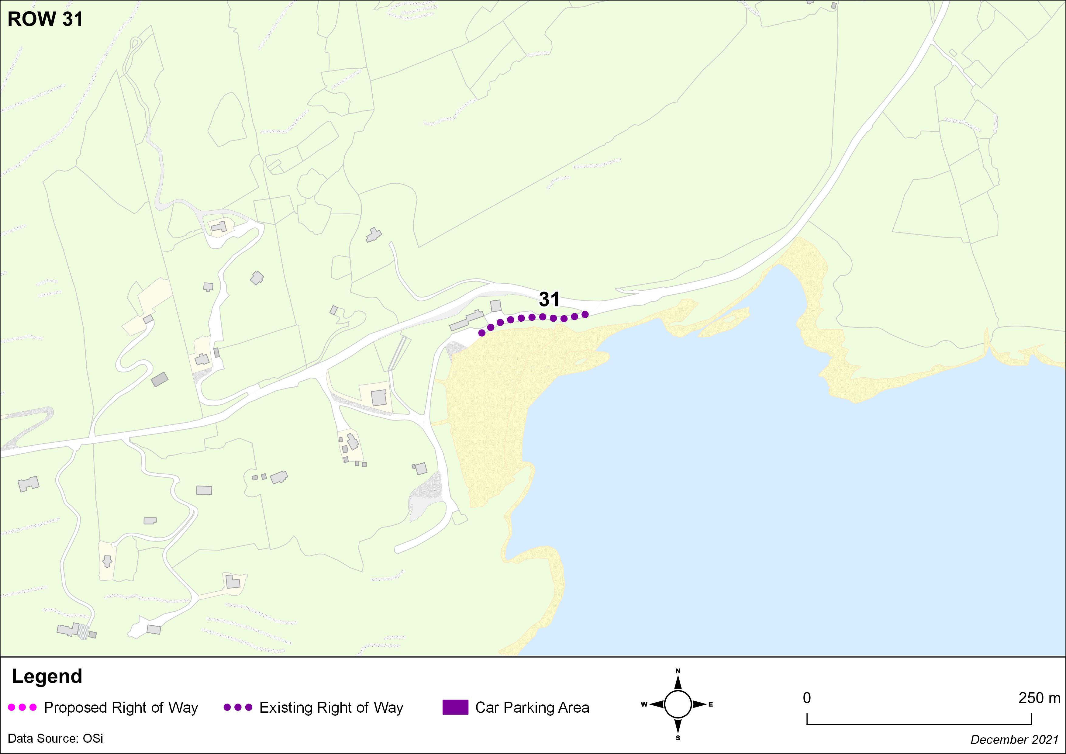
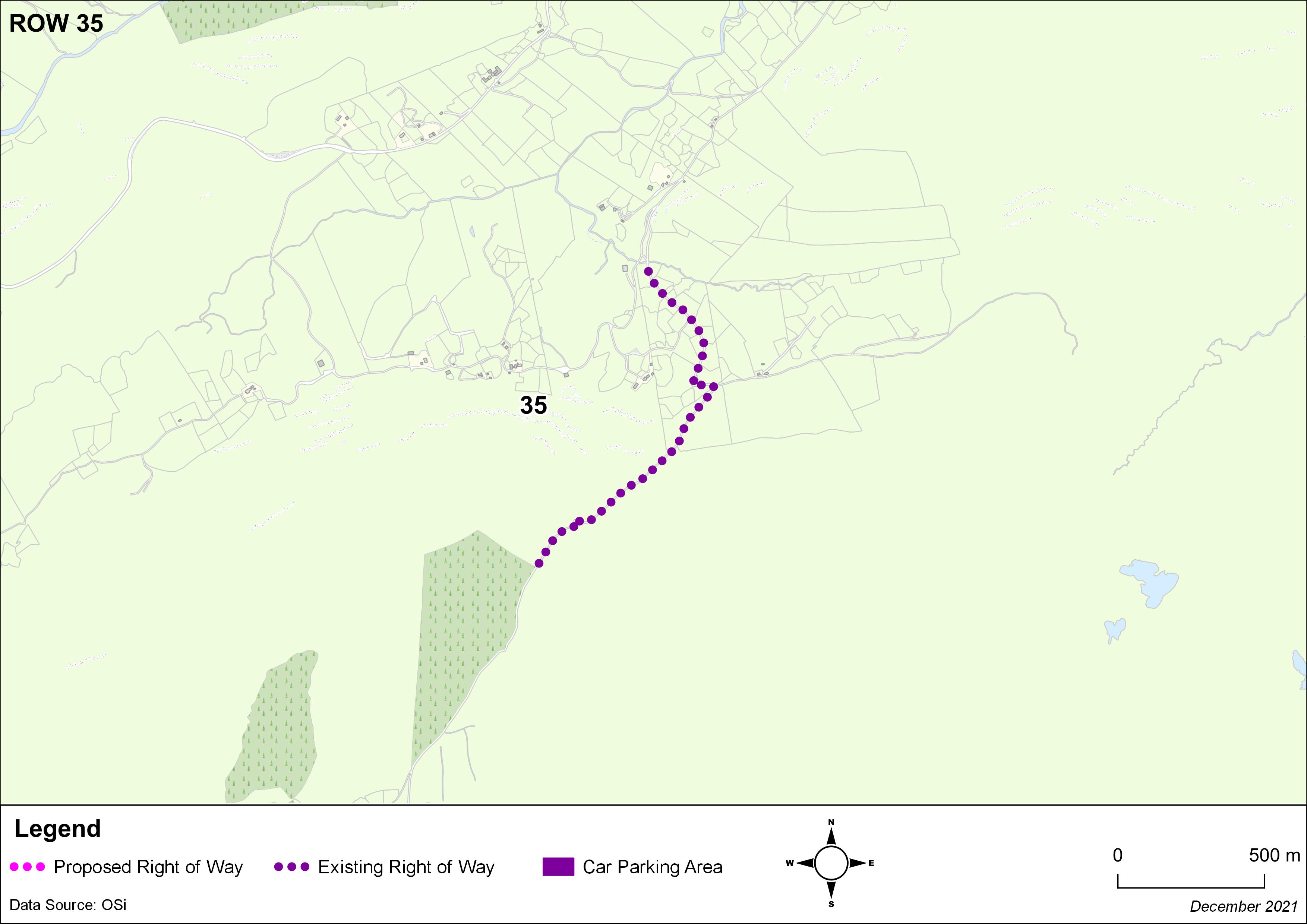
From the end of the L11597 to the beach at Coomatloukane. |
[1] Proposed Right of Way
Contents
Materials
Observations
Observations
I Fiona Ní Shúilleabháin Farraniaragh wish to support the inclusion of an access road to Coomatloukane Beach, as a registered Right of Way
Ballylongford Enterprise Association is a community led organisation whose aim is to promote and develop Ballylongford. Tourism is a huge factor in our development and strategic plan. Carrigafoyle...
The lakes of Killarney are one of the most recognized features of the county both throughout the country and worldwide. Traditionally in Killarney, individuals and families would have access to the...
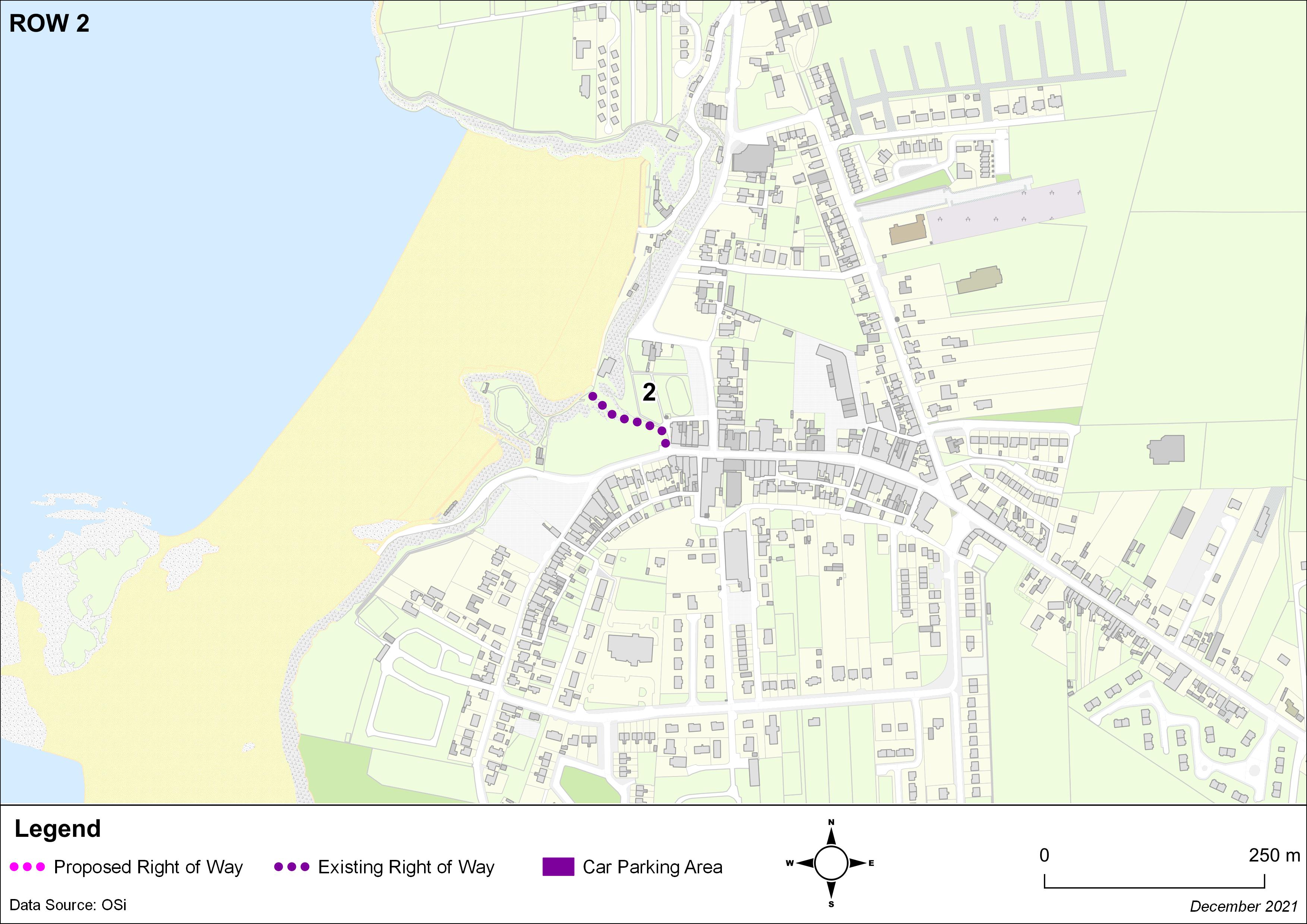
Re: Proposed Right of Way 6b Access to the beach from the L10483 at Carrahane Lower
I refer to the proposal to add the above to the list of public rights of way. I would like to put it on...