Duagh Area - Open to Consideration Maps
Volume 4: Maps
Closed6 Dec, 2021, 00:01 - 23 Feb, 2022, 17:01
Volume 4 - Maps
This volume contains the following maps associated with the plan.
Contents
1. Tralee, Killarney & Listowel Zoning Maps
4. Visually Sensitive Areas and Views & Prospects
6. Tarbert-Ballylongford Landbank
An interactive map is available for the Draft Kerry County Development Plan 2022-2028 where all these maps can be viewed, which also includes the Material Amendments.
1. Tralee, Killarney & Listowel Zoning Maps
2. Settlement Hierarchy
3. Rural Area Types
4. Visually Sensitive Areas and Views & Prospects
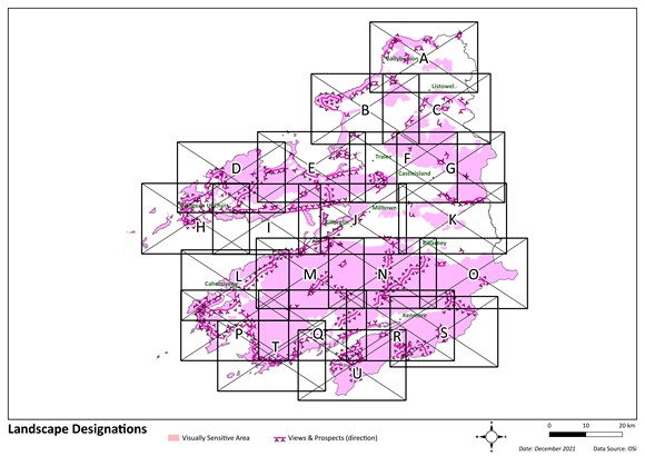

| Map A | Map B | Map C |
| Map D | Map E | Map F |
| Map G | Map H | Map I |
| Map J | Map K | Map L |
| Map M | Map N | Map O |
| Map P | Map Q | Map R |
| Map S | Map T | Map U |
5. Wind Zoning
6. Tarbert-Ballylongford Landbank
Contents
Observations
Observations
Submission for review for proposed areas open for consideration in the Kerry County Development plan 2022-2028 related to the wind maps zoning in Duagh area for wind energy
Submission for review for proposed areas open for consideration in the Kerry County Development plan 2022-2028 related to the wind maps zoning in Duagh area for wind energy